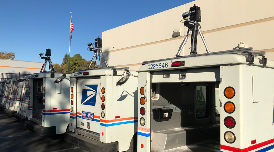
The Postal Service recently tested the ability of USPS vehicles to collect geospatial data, which can be used for electronic navigation applications and other geospatial-based technologies.
During the test, the organization worked with Microsoft, which collects panoramic, three-dimensional imagery of city streets and other locations for Streetside View 360, the company’s mapping program for mobile devices and computers.
The program relied on vehicles equipped with special sensor systems, including rotating light detection and ranging data technology, to capture images in 3D.
Three postal vehicles were fitted with special equipment to capture 3D street imagery data during normal deliveries on 40 city routes in Mountain View, CA. To protect the privacy of individuals during the data-capture efforts, faces and license plates were blurred or erased.
“This test was part of the Postal Service’s commitment to use its unparalleled delivery vehicle network and existing infrastructure to help other organizations deliver quality services to their customers. The test also allowed us to explore new ways to generate revenue for USPS,” said Lauren Lee, digital business services director.
Crystal Chen, the officer-in-charge at the Mountain View Carrier Annex who helped oversee the test, also expressed “excitement at the opportunity to use the delivery fleet in such a new and innovative way.”
The Postal Service and Microsoft are reviewing the test results to evaluate the feasibility of a new geospatial data product that could continue to leverage the organization’s route network of more than 230,000 vehicles.
Share your feedback at uspslink@usps.gov. Your comments could be included in the “Mailbag” column.

